- Call Us Anytime
- 01719276403
- Opening Time
- 12 hours
- Email Us Now
- nandanickbd111@yahoo.com
Digital Survey
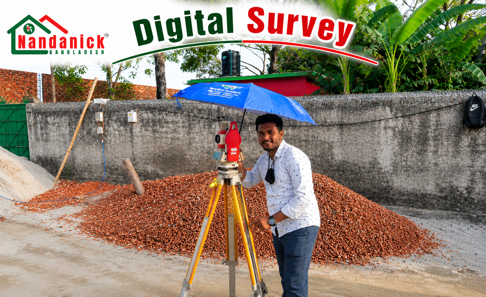
*Nandanick
Bangladesh Ltd.* provides professional geometrics, engineering, hydrographic,
cadastral, and geospatial surveying services using advanced technologies
including *GNSS/GPS, Total Station, Digital Level, UAV (Drone), LiDAR, GIS,
Remote Sensing, 3D Laser Scanning, Mobile Mapping, and Hydrographic Survey Systems*.
Our survey deliverables support engineering design, infrastructure development,
land administration, environmental management, and construction monitoring
while complying with international standards and Bangladesh regulations.
1. Topographical Survey
We conduct high-precision topographical surveys to capture natural and man-made features, contours, elevations, utilities, vegetation, waterways, and terrain characteristics required for planning, engineering design, and construction.
* Applications* Roads & Highways* Bridges* Railways* Power Plants* Industrial Facilities* Residential Developments* Commercial Projects* Airports* Land Development* Utility Corridors
2. Geographical (GIS) Survey
We collect, analyze, and manage spatial information using GIS, GNSS, UAV, satellite imagery, and remote sensing technologies to support:
* Urban Planning* Smart Cities* Land Information Systems* Environmental Management
* Resource Mapping* Infrastructure Planning* Disaster Risk Assessment
3. Boundary Demarcation Survey
Our cadastral and legal boundary surveys accurately establish, verify, restore, and demarcate property boundaries using Survey of Bangladesh records, cadastral maps, deed documents, and modern surveying instruments.
Applications include:
* Land Registration* Property Transfer* Land Acquisition* Court Cases* Boundary Dispute Resolution
* Industrial Development
4. Level, Spot & Reduced Level (RL) Survey
We determine accurate ground elevations, benchmark levels, and Reduced Levels (RL) for engineering and construction projects.
Applications
* Building Construction* Drainage Design* Road Formation* Foundation Design* Earthwork Planning
* Flood Protection
5. Contour Survey (2D & 3D)
We prepare Digital Terrain Models (DTM), Digital Elevation Models (DEM), and contour maps for engineering analysis and land development.
Deliverables include:
* 2D Contour Maps* 3D Terrain Models* Surface Analysis* Slope Analysis* Watershed Mapping
6. Earthwork & Volume Survey
We perform accurate volume computations for:
* Excavation* Cut & Fill* Sand Filling* Dredging* Stockpile Measurement* Quarry Volume
* Reservoir Capacity
using UAV photogrammetric and Digital Terrain Modeling.
7. Road & Highway Survey
Our engineering surveys include:
* Route Alignment* Centerline Survey* Longitudinal Profile* Cross Sections* Pavement Survey
* Utility Mapping* Right-of-Way Survey* As-Built Survey
8. Bridge Survey
Our bridge engineering surveys include:
* Alignment Survey* Foundation Layout* River Cross Sections* Hydrographic Survey* Structural Monitoring* Deformation Monitoring* As-Built Verification* Bridge Rehabilitation Survey
9. Railway Survey
We provide railway engineering surveys for:
* Route Selection* Track Alignment* Longitudinal Profile* Cross Sections* Corridor Mapping
* Track Geometry* Construction Layout* Rehabilitation Projects
10. Elevated Expressway & Flyover Survey
We perform:
* Alignment Control* Pier Setting Out* Structural Layout* Utility Identification* Construction Monitoring* Deformation Monitoring* As-Built Survey
using GNSS, Total Station, Laser Scanner, and UAV technologies.
11. Stadium & Sports Complex Survey
Survey services include:
* Site Layout* Earthwork Survey* Structural Grid Setting* Utility Survey* Topographic Mapping
* Construction Monitoring
12. Irrigation & Canal Survey
Our irrigation engineering surveys include:
* Canal Alignment* Water Level Survey* Hydraulic Profile* Cross Sections* Command Area Mapping
* Drainage Assessment* Water Resource Planning
13. River & Hydrographic Survey
We conduct:
* Bathymetric Survey* River Cross Sections* River Training Survey* Sediment Analysis
* Bank Erosion Assessment* Navigation Channel Survey* Floodplain Mapping
using Echo Sounders, RTK GNSS, ADCP, and Hydrographic Survey Systems.
14. Dam & Reservoir Survey
Services include:
* Reservoir Capacity Survey* Bathymetric Survey* Dam Deformation Monitoring* Settlement Monitoring* Structural Assessment* Reservoir Sedimentation Study* Safety Inspection Survey
15. Power Plant Survey
We provide engineering surveys for:
* Thermal Power Plants* Combined Cycle Plants* Solar Power Plants* Wind Farms* Hydroelectric Projects* Nuclear Power Facilities
Services include:
* Control Network* Construction Layout* Deformation Monitoring* Utility Mapping* As-Built Survey
16. Overhead Transmission Line Survey
Engineering survey includes:
* Route Alignment* Tower Spotting* Profile Survey* Cross Sections* Right-of-Way Survey
* Obstacle Survey* Tower Foundation Setting Out
17. Underground Utility Survey
We identify and map underground:
* Power Cables* Gas Pipelines* Water Supply Networks* Sewer Systems* Storm Drainage
* Telecommunication Cables* Fiber Optic Networks
using GPR (Ground Penetrating Radar), Electromagnetic Locators, GNSS, and GIS.
18. Construction Setting-Out & As-Built Survey
We provide:
* Grid Layout* Column Setting* Foundation Layout* Structural Positioning* Verticality Survey
* As-Built Documentation* Quality Verification
19. UAV (Drone) Survey & Photogrammetric
Our UAV services include:
* Orthophoto Mapping* 3D Surface Modeling* Digital Terrain Models* Volume Computation
* Progress Monitoring* Construction Inspection* Corridor Mapping
20. Deformation & Monitoring Survey
We monitor:
* High-rise Buildings* Bridges* Dams* Towers* Industrial Plants* Chimneys* Slopes
using precision GNSS, Total Station, Digital Level, and Laser Scanning.
*International Surveying Standards
Nandanick Bangladesh Ltd. performs surveying services following internationally accepted engineering and geometrics standards, including:
* *International Federation of Surveyors (FIG)* Guidelines
* *ISO 9001:2015* – Quality Management Systems
* *ISO 19100 Series* – Geographic Information & Geometrics
* *ISO 17123 Series* – Field Procedures for Testing Surveying Instruments
* *ISO 4463* – Setting-Out and Measurement in Building Construction
* *ISO 6709* – Geographic Coordinates
* *OGC (Open Geospatial Consortium)* Standards
* *ASTM International Standards* (where applicable)
* *International Hydrographic Organization (IHO S-44)* Standards (for Hydrographic Surveys)
* *ICA (International Cartographic Association)* Guidelines
**Our Report Comply Eligibility & Professional Qualifications of Surveyor
To ensure credibility, transparency, and technical excellence, valuation assignments should be undertaken by qualified professionals with appropriate education, training, and experience.
# Recommended Professional Qualifications
* B.Sc. or M.Sc. in Civil Engineering
* B.Sc. in Architecture
* Urban & Regional Planning
* Quantity Surveying
* Mechanical Engineering (for Plant & Machinery Valuation)
* Electrical Engineering
* Naval Architecture & Marine Engineering (for Vessel Valuation)
* Agricultural Engineering (for Agricultural Assets)
* Finance, Accounting, Economics, or Business Administration (for Financial and Business Valuation)